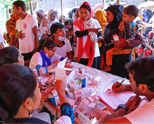
MSF doctor kneels next to young girl with cast on her leg

Photo: MSF

By Médecins Sans Frontières

As a project manager for MSF (Médecins Sans Frontières/Doctors Without Borders), a medical emergency humanitarian agency, I attended this year’s South by Southwest (SXSW) festival in Austin, Texas, in the company of a friend and collaborator from Google who is involved in crisis mapping. We gave a presentation on some mapping work we had done together, and inevitably we discussed the differences and similarities in our geek (high-technology) and primitive fieldworker (humanitarian) cultures.

The two cultures are, on the face of it, rather distinct.

Geeks live in highly connected environments, usually urban, surrounded by technological infrastructure straight from the most outrageous science fiction of decades past. They inhabit an intellectual world of abstractions: math, code, logic, creativity, and business; while their physical existence is supported by a seamless layer of luxury and connectivity. The food, and the coffee, is good.

Humanitarian fieldworkers live a variety of environments from luxury hotels or palatial mansions to mud huts or tents, with variable connectivity, but almost always with constraints. Even in the most modern of African or South Asian capitals the technological infrastructure is often wobbly; there may be high-speed internet but it usually features random periods of downtime. In the mud hut scenario, internet and telephone use generally involves a satellite rig, great expense, and substantial cursing at the fiddly configurations and on-again-off-again unreliability. Our lives are never far abstracted from the constant effort required to enable working conditions, and the intensely pragmatic work of solving immediate problems. That patient is in danger of dying NOW, that refugee camp needs clean water NOW, and if we don’t get the car fixed in the next few hours we’ll be spending the night by the riverbank eating dry emergency ration biscuits. Most of us have at one time or another shared a single broken-down laptop with several people, a leaky thatched roof over a mud floor, and a plate of sandy, oily rice that is as good as we’re going to get for dinner.

Despite these disparate viewpoints (abstraction vs. immediate physical pragmatism) and differing ecological niches (urban café vs. mud hut) there is an unexpected similarity; primitive fieldworkers and geeks share a culture of problem-solving. Nothing makes a geek happier than a tough problem that gets all the neurons firing, and nothing makes a fieldworker happier than a serious emergency that gets the adrenaline flowing (if that sounds callous, in our defence it’s not the suffering that we enjoy, but the chance to make a real difference with our work).

At SXSW we had the chance to share that cultural crossover with a broad audience of geeks, fieldworkers, and an assortment of others, all of whom shared an interest in the intersection of humanitarian work and technology.

My main take-home message was: we are not alone.

We humanitarians tend to take pride in our ability to deal with problems by stretching our ingenuity and using only what is available in the field. My friend from Google was astounded at what we do with spreadsheets, saying “I didn’t think that this could be done without software coding capacity”. We use spreadsheets as databases, stock management systems, maps, payroll systems, and sketchpads. This is, perhaps a strength but I am beginning to realize that we take it too far. There is an enormous community out there in the world, with increasingly robust electronic links to even the most remote field locations, who can help us. Open source code can be written to address problems that we would normally tackle with tortuous repurposing of spreadsheets; there are incredibly talented programmers delighted to donate their efforts, especially to interesting problems. Informal slums can be mapped by volunteers, either people who once lived in the country or even by people who have never been there simply hand-tracing satellite imagery. The astounding success of the Ushahidi project (follow the link to read about an open-source crisis mapping project that started in Kenya to assist people during electoral violence and has since been used around the world, including Washington DC, to map emergencies) shows the power of crowdsourcing or distributed voluntarism to assist people in crisis.

Humanitarians need tools and information, particularly during crises. The tech world is bursting with possibilities to provide just that, often free of charge and with an astonishing level of professionalism. I hope that this meeting of cultures continues to deepen and that the early promise of these innovations translates to real benefit to the populations in crisis that we serve.

Ivan Gayton

Ivan Gayton is a project manager with Médecins Sans Frontières, currently working in Nigeria. During the Haiti cholera outbreak in 2010, he worked together with a team from Google to develop tools to map the outbreak using freely available software (Google Earth). He and Google’s Pablo Mayrgundter continue to work on an open-source epidemiological mapping tool in their scant spare time. Other than an interest in seeing further cultural cross-pollination between humanitarians and techies, Ivan has no conflict of interest, and no financial interests whatsoever in the matter.

This and many other MSF blogs are available at PLoS – Speaking of Medicine http://blogs.plos.org/speakingofmedicine/category/msf-2/

PEPID Elements: Environmental Medicine & Disasters allows users to identify natural resources around them that can be used in emergency situations. The app includes identification, management and treatment of environmental disaster medicine conditions including mountain medicine, survival situations for both natural and manmade scenarios, heat injury and illness, cold injury and illness, electrical and lighting injury, and bites and stings. The comprehensive treatment section has a complete drug database containing adult and pediatric dosing, indications, adverse reactions and administration information. Elements was designed by PEPID, provider of medical software and drug databases.

Photo Credit: iRevolution

The World Bank and Google have announced a collaborative agreement to use a free, web-based mapping tool called Google Map Maker that enables citizens to directly participate in the creation of maps by contributing their local knowledge.

The agreement is aimed at improving disaster preparedness and development efforts in countries around the world. Under the agreement, the World Bank will act as a conduit to make Google Map Maker source data, more widely and easily available to government organizations in the event of major disasters, and also for improved planning, management, and monitoring of public services provision.

The Importance of Local Knowledge

The most innovative component of this agreement, I believe, is the effort to blend scientific and local knowledge to solve local solutions. The need for integrating modern technology and indigenous knowledge into disaster management and prevention has long been overdue. While the technical capability of the new ICTs is huge, it also requires the mobilization of human resources, especially locally available human resources in tackling such disasters.

Just as the expertise of local citizens are being utilized to project their views in urban centers/cities through data-mapping, local knowledge, which is context specific, could be used to interpret the natural landscape of past natural disasters and using these indicators to help in forecasting future disasters. Studies have shown that local knowledge practices are cost effective, and incorporating them into scientific projects could help build local trust of the people. The use of local knowledge such as weather predictions, smells, sounds, cloud color, direction and types of wind, appearance and movements of insects, etc. could be tapped into, in disaster prone communities to help develop sustainable measures in interpreting early warning signals of natural disasters.

Google Map Maker

The Google Map Maker data includes detailed maps of more than 150 countries and regions, and identifies locations like schools, hospitals, roads, settlements and water points that are critical for relief workers to know about in times of crisis. The data will also be useful for planning purposes, as governments and their development partners can use the information to monitor public services, infrastructure and development projects; make them more transparent for NGOs, researchers, and individual citizens; and more effectively identify areas that might be in need of assistance before a disaster strikes.

The World Bank Institute (WBI) and the Global Facility for Disaster Reduction and Recovery (GFDRR) will manage the World Bank’s involvement in the collaboration, building on previous joint mapping efforts. For example in April 2011, members of the Southern Sudanese Diaspora participated in a series of community mapping events organized by World Bank and Google to create comprehensive maps of schools, hospitals and other social infrastructure in this new country via Map Maker technology.

Google has enjoyed a strong relationship with World Bank for many years. As indicated by the World Bank Vice President for the Africa Region Obiageli Ezekwesili, “Today’s technology can empower civil society, including the diaspora, to collaborate and support the development process. This collaboration is about shifting the emphasis from organizations to people, and empowering them to solve their own problems and develop their own solutions using maps.”

Read more on the agreement and possible partnership and collaborations with the World Bank offices.

A recent study undertaken in Haiti found that mobile phones can deliver critical information on population movement rapidly and accurately following disasters.

Richard Garfield presented the findings from the research he conducted with several other public health specialists and social scientists at a recent mHealth working group meeting using data from mobile phone networks before and after the 2010 earthquake that rocked Haiti. The publication explains how the research team used position data of SIM cards from Haiti’s largest mobile phone company, Digicel, to estimate population movement trends following the earthquake and the subsequent cholera outbreak.

Girls with phone in Haiti after earthquake- from USAID

Photo credit: USAID

The researchers originally set out to find this data in order to respond to the disaster in Haiti. Knowing that 1 in every 3.8 people in Haiti owned a cell phone, they collaborated with Digicel to track the number of calls and the location of those calls over the course of a year, before and after the earthquake. Most mobile users were based in Port-au-Prince where the earthquake was centered. While cell reception was down for a few days immediately following the quake, the network capacity was rapidly re-established, making the phones easy to trace.

A 22 % decline in phone usage in Port-au-Prince after the quake correlated with the massive outflow of population from the capital, which was widely known. In the aftermath of the disaster, the UN and Haitian government had created maps based on eyewitness observation to track population movements. But because these were reliant on eyewitnesses, there was no way to tell how accurate the data was.

In fact, the mobile phone usage analysis showed different results from these official maps, showing movement that was more spontaneous and seemingly more accurate. Many of those who evacuated Port-au-Prince originally returned back within 7 days, and this was something the official numbers did not catch right away. Months after the earthquake when the UNFPA carried out a survey in Haiti to retrieve more accurate numbers of where people were and when, the mobile phone data was much more closely associated with these results. The mobile phone data also helped to estimate where the cholera outbreaks were happening and to get people out of the danger zones.

Graph from Richard Garfield mobile data in Haiti article

Estimated net changes of the Port-au-Prince population compared to the capital's population on the earthquake day


Garfield emphasized that while these results do not indicate that mobile data should be used as final, official counts on death tolls, it can provide initial estimates while waiting for more accurate counts. The key point is to mine the data rapidly and assist in a quick response.

Will this research lead to improved quick responses for future disasters? It certainly could be combined with current disaster relief efforts following the recent earthquake in Turkey, such as Google’s Person Finder app or social media response.

This article by Andrew Quinn originally appeared on Reuters.com.

  A Somali resident purchases a cell-phone handset at a shopping centre in Mogadishu, November 4, 2009.  Credit: Reuters/Feisal Oma

A Somali resident purchases a cell-phone handset at a shopping centre in Mogadishu, November 4, 2009. Credit: Reuters/Feisal Oma

Cell phones may bring relief to famine victims in parts of Somalia controlled by al Shabaab insurgents as donors seek new ways to circumvent the hard-line militants, a senior U.S. official said on Tuesday.

Rajiv Shah, head of the U.S. Agency for International Development, or USAID, said that despite al Shabaab’s ban on foreign aid in regions they control, progress was being made to reach about 2.7 million people desperately in need of help.

“It is difficult to provide large-scale commodity support. Food convoys have been attacked, so we’re trying a number of more innovative approaches,” Shah told Reuters on the sidelines of the U.N. General Assembly in New York.

Cell phone networks and the traditional “hawala” money transfer system used in many Islamic societies are two such routes, Shah said, while aid groups from Gulf Arab countries and elsewhere were also making inroads.

“We’re trying cash distributions through the hawala system and through mobile phones and then concomitantly flooding border markets with food so that traders can then make the connections,” Shah said.

Al Shabaab, a hard-line Islamist group linked to al Qaeda which controls most of the southern part of Somalia, banned food aid last year and kicked many groups out, saying aid creates dependency.

Some 3.7 million Somalis are at risk of starvation in the worst drought in decades, including some 2 million in rebel-held regions were most major aid agencies cannot reach.

Some local agencies are allowed to deliver aid to these areas, but this is not enough for all those who need it.

The rest of Somalia is expected to slide into famine by the end of the year as the drought gripping the Horn of Africa affects more than 13 million people.

Shah said U.S. efforts to improve agricultural techniques and technology in the region, coupled with economic support programs to make local communities more resilient, had helped to prevent the famine from broadening into a wider crisis as it did 1984-85 and again in 1998-2000.

But he said the situation remained critical, and new strategies aimed at enabling people to secure food supplies close to home were aimed at forestalling a broader flood of refugees to already overburdened camps.

“People leaving their communities going on these treks where they almost certainly will be assaulted, robbed, often raped,” Shah said. “The risks of participating in humanitarian action in the place they are is probably considerably lower.”

EXEMPTIONS NOT ENOUGH

The United States in August said it would not invoke anti-terror laws to prosecute nongovernmental groups working in southern Somalia if some aid falls into the hands of al-Shabaab, which is on the official U.S. terror blacklist.

But Shah said the exemptions had had little effect as most foreign aid organizations continued to have almost no safe access to al Shabaab-controlled regions.

The United States has contributed about $600 million to famine relief efforts in the Horn of Africa, more than half the total global response.

But Shah said he was worried that future efforts could be hobbled as U.S. lawmakers try to find a further $1.2-$1.5 trillion in budget cuts to trim the huge U.S. federal deficit.

“I am extraordinarily worried because that would be very counterproductive,” he said, saying a further destabilization of Somalia and strengthening of al-Shabaab could have direct security consequences for the United States.

Somali women in search of food and shelter

Credit: Associated Press

An 11-year-old Ghanaian schoolboy is spearheading a campaign in support of Somalis after seeing footage of people walking in search for food.

With an ambitious target of $13 million, Andrew Andasi has raised over $4000 for victims of the famine in the Horn of Africa as of August, and is joining the ranks of celebrities such as Lady Gaga, Justin Beiber and Rihanna by using social media to advocate for famine relief. This ability to instantly transmit images and videos on issues as they happen could have a unique impact on disaster response and humanitarian assistance.

Social media (SM), which embodies the emerging online relational tools, methodologies, and applications that allow groups of people to interact with one another by exchanging content, opinion, and insight, continues to have significant impact on awareness creation and dissemination of information in times of emergency. The on-going humanitarian crisis at the Horn of Africa is a testament to how SM could be of immense help in times of disaster.

In addition to the immediacy of SM to responses, the new technologies and applications have shifted power from the hands of the few to the masses. SM has proven to better facilitate two-way communication than the traditional media, and also ensures richer interaction between and among people. It is relatively inexpensive and easily accessible with minimum investment of resources.  SM also by their nature, are very decentralized and less hierarchical thereby providing scale and high capability of reaching a global audience. It requires minimal training, skills and expertise to use.

How is SM being used Differently in this Crisis?

Unlike earthquakes, tsunamis, and tornadoes, famine has a strong human component. Famines happen when countries and regions are not equipped to deal with extremes in weather. Notwithstanding, there have been a number of criticisms with the limited use of SM at the Horn of Africa for awareness creation and fundraising in support of the victims compared to other disasters such as the Haiti earthquake, and Japan tsunami. Examination of the use of SM at the Horn of Africa shows that these applications are progressive rather than instantaneous. Instead of a surge in the number of tweets and SMS messages as seen in natural disasters, there have been proliferation of Facebook groups such as Somalis without Borders for Drought Relief, and Africans Act 4 Africa among others. While several theories have emerged to explain the slow response – the volatile political situation in Somalia; the US debt ceiling; the mobile phone hacking scandals by the News of the World in Britain; and the killings in Norway, it is also important to understand the nature of the disaster – being progressive rather than instantaneous.

Time for Action

In July, the United Nations (UN) officially declared a famine in two regions of southern Somalia and this has extended to five regions in August. Over ten million people across the Eastern Horn of Africa are now suffering from one of the worst food crisis the world has seen in decades – United Nations World Food Program (WFP).

But the time now is for action – emergency rather than accusation. “We need the contributions of caring individuals here in the United States and around the world…we have seen this in previous crises, from the Indian Ocean tsunami in 2004 to the earthquake in Haiti; individual donations can have a tremendous impact” Said the US Secretary of State. This is why we need the power of social media. The active utilization of the new ICTs and SM for disaster response continues to improve over the years. Celebrities across the world are tapping into the magic of SM to garner support for innocent women and children. For the past few months, several news headlines have appeared showing how SM is reaching out to the public about the problem and also soliciting support for the people.

Simply capturing and transmitting images and videos that other people have posted could have a significant impact on ordinary citizens like Andrew Andasi to take action – that is the potential power of SM.

One of the things that I spent a great deal of my time during the first half of this year is being launched today. With great support from Intel and Microsoft we at NetHope are launching a 60 page case study report on the use of information and communication technology (ICT) in the Pakistan floods last year.

In this report we look at how the humanitarian community responded, how ICT played a role in the response and how information management was utilized during the response.

Back in 2006, Paul Currion wrote a report on the use of ICT in the 2005 Pakistan earthquake. In our report we look back at his findings and identify ways in which things have progressed in these five years. Interestingly enough in many cases not much has changed.

One of the key things that has changed in these five years is easier access to connectivity. Whereas in 2005 most organizations relied upon V-SATs as the only available connection, the humanitarian organizations today relied much more upon broadband and mobile connections.

It is our hope that this report provides a great insight into the state of ICT and information management within the humanitarian system and that it generates discussions on how to further improve.

I want to use this opportunity to thank all those who contributed to the report, either by responding to our survey or be willing to participate in our interviews. Last but not least I want to thank everyone who helped review my often rough text and special thanks to our media queen Paige for making the report look so nice.

The report can be downloaded here

Information and communication is the lifeline of any disaster response. It is critical for people on the ground to convey the situation, as well as the urgent need for supplies and relief in specific locations. It helps organizations collaborate to avoid duplicative effort and gaps in assistance.

The crisis response community has long known that the use of information and communications technology (ICT) can quickly coordinate efforts, thereby making their work more targeted and effective. Recent improvements in ICT, such as availability of BGANs, WiMax and WiFi mesh networks, provide an opportunity to improve information sharing, not only within organizations but also between them.

This blog post illustrates the need for a coordinated collection of baseline data in disaster prone countries through a cross-organizational, multi-phased approach.

The humanitarian sector has the opportunity to harness technological advancements to improve information-sharing during a crisis. Technology is not the solution. But it is a significant tool that can enhance intelligent and immediate decision-making.

The State of Crisis Information Management

Numerous challenges in information management arise when responding to a major disaster or conflict, such as:

  • recording the damage to housing, infrastructure, and services
  • tracking displaced populations
  • distributing the massive influx of humanitarian supplies
  • coordinating the work in and between clusters, as well as the work of dozens of agencies outside the cluster approach

A recent survey of organizations that responded to the devastating earthquake in Haiti pointed out that one of the key issues they faced was an overall lack of baseline information about the situation in the country. For many of the UN clusters operating, it took months to get a comprehensive overview of what the situation was like before the earthquake struck, and then to start understanding what effects it had.

In Haiti the situation was particularly devastating because almost all government offices and ministries had been destroyed in the earthquake, and most of their data systems were lost. This is a common issue faced by response organizations around the world.

Baseline and post-disaster information is collected and controlled by many autonomous parties, including national authorities, many of whom may be working together for the first time. Due to the lack of a common repository of baseline data, organizations spend considerable amount of time either recreating the data or searching for it. Therefore, it is important to improve access to, and interoperability of, data collected before, during, and after an emergency. This is essential to building better response capacity.

Humanitarian response to sudden onset disasters requires:

  • rapid assessment of the spatial distribution of affected people and existing resources
  • good geographical information to plan initial response actions
  • shared knowledge of which organizations are working where (who-what-where or “3W data”) so that response can be coordinated to avoid gaps and overlaps in aid

This applies to any humanitarian response. But in a sudden onset disaster, the timeframes of information supply and demand are severely compressed. Pre-assembled information resources for the affected area may not exist. Even in areas where development projects have been present before the crisis occurred, data is often dispersed and unknown by the wider humanitarian community, or cannot be accessed and assimilated quickly enough.

Recurring data problems include:

  • Discoverable data. Data is either not made available to, or is not discoverable by, relevant organizations.
  • Available data. Data may not be immediately accessible, archived, or stored/backed up in a location outside of the devastated area.
  • Released data. Data sets may be subject to legal restrictions. Even if these restrictions are waived for humanitarian use, there may be problems with immediate authorization and redistribution.
  • Formatted data. Data may be unsuitable for direct import into a database or GIS system, and may require substantial processing.
  • Conflicting data.

Emergencies create an ever increasing number of information web portals, which is in itself a good thing. However, it can be problematic when the data is rapidly evolving. The enthusiasm to (re)publish as much information as possible can lead to confusion and inefficiencies, as users search through multiple copies of similar looking data to extract what is new or different.

The above issues are widely recognized by practitioners in humanitarian information management. Still, these problems recur in almost every sudden onset disaster emergency, in both developed and developing countries.

Each emergency brings together a unique collection of local, national and international humanitarian players. Some are experienced emergency responders, and some are not. Some are government-endorsed, whilst others are simply concerned citizens. While there will be some common elements across every emergency (government, UN agencies, major INGOs), the varying roles played by each makes it impossible to predict a ‘humanitarian blueprint’ for each new emergency. This vast range of experience, resources, and mandates, can make sharing response best practices extremely difficult.

Common problems with baseline data can – and must – be resolved for each emergency. For example:

  • During the initial days of an emergency, the main coordinating agencies agree at a national or local level which administration boundaries and P-code datasets should be used for coordination. It is critical that this decision is communicated to everyone involved in the disaster response.
  • Humanitarian assessment templates and base map data should be standardized and made compatible.
  • The supply of baseline data should be driven by the information needs of the humanitarian response. Priorities differ from emergency to emergency, and this presents a constant challenge in using limited resources to meet urgent information needs at each stage of the response.
  • The information needed by the affected community is not necessarily the same as the information demanded by large humanitarian agencies.

A well-coordinated humanitarian response will use multiple datasets, created by different personnel in different agencies, describing a highly dynamic and multi-faceted situation. To make these datasets interoperable and manageable imposes a higher overhead cost. But to create a data model that is planned strategically versus reactively will minimize that cost.

Moving forward

A multi-agency effort is essential to improve the availability and accessibility to baseline and crisis information. This needs to be a collaborative effort of the entire humanitarian response community with support and involvement of the private and academic sectors. The now no longer existing IASC Task Force on Information Management did a good job by defining what the Core and Fundamental Operational Datasets (COD/FOD) are that we need to collect for each country, but the difficult part is to actually ensure they are available for each country and that those that have been collected are actually kept up to date.

We at NetHope are looking at new and innovative ways to address this and are looking for organizations who are interested in working with us on this. If you want to work with us on this, feel free to reach out to me for further information.

Over the last two years we have had endless discussions about how crowd sourced information is going to change the way we do crisis information management. Some people go as far to say as the regular humanitarian information management is dead and that the time of crowd has come. But one thing that we have yet to show is that all this crowd sourced information actually provides the humanitarian response community with actionable information. We have a few anecdotes of individual reports being helpful, but no overall study of the effectiveness.

I have lately been talking to a number of colleagues from the humanitarian community and one of the best hint at how to solve this came from Lars Peter Nissen from ACAPS. He pointed out that when they are planning needs assessments they start by defining what decisions they want to try to affect by the needs assessment. Then they work their way backwards and design an assessment that helps provide the answers needed to make that decisions.

When deciding to do a crowd sourced project for a disaster or crisis response, we must do the same. We must first define what decisions we are trying to affect. Once we know what decisions we want to try to affect, we need to define what information we would use as the basis for making these decisions. Once we know what information we would use as basis, we should look at what is the best way to visualize that information to optimize the decision making. In the age of crowd sourcing we have focused a bit too much on the power of geospatial visualization, but often graphs, trends or tables can help us make a better decision.

Once we know what decisions we want to help facilitate and how we want to visualize them, then we can start thinking of how we can get data from the crowd and through data processing and data analysis turn that data into this information. This may lead us to ask the crowds for more controlled questions or for our media monitoring teams to monitor reports of certain data instead of trying to capture all the available data out there. We can then look at ways of either automatically process the data or use a mechanical turk to utilize a “crowd” to do that processing. Same applies to taking that processed data and analyzing it. This can either be automatic or done via a crowd of people.

So before the next major disaster happens and we activate the digital volunteers lets sit down and define the end product first and then work our way back. This way we can really ensure that all this digital volunteer effort is utilized to the max.

Malnourish child in hospital Photo Credit: Abdi Warsameh, AP

Photo Credit: Abdi Warsameh, AP

Farhiya Abdulkadir, 5, from southern Somalia, suffers from malnutrition and lies on a bed at Banadir hospital in Mogadishu, Somalia. Her growth is stunted, her belly engorged, and the muscular tissues keeping her organs functioning are slowly wearing away—the five-year-old is deteriorating to death.

Farhiya is dying from famine, starvation, and malnutrition; but a packet of the peanut buttery Plumpy’nut could help bring her back to life.

The U.N. declared a famine late last month in parts of southern Somalia where tens of thousands of people, mostly children, have died, in what aid officials call the worst humanitarian crisis in the troubled country in over two decades.

Despite dire conditions, where one-third of the population of Somalia is facing starvation, militant Islamist group al-Shabaab has been deflecting international aid where help is needed the most.

A couple weeks ago, Edward Carr who works in famine response for USAID on the ground in the Horn of Africa, observed that despite similar drought conditions in Kenya and Ethiopia, the state of Southern Somalia is critical, “we cannot get into these areas with our aid…famine stops at the Somali border”.

How does he know, then, exactly where aid is needed, how much is needed, and will be needed in the upcoming months?

The USAID-supported Famine Early Warning Systems Network (FEWS NET) is a system helps to identify timely information on the most affected areas, urging the global humanitarian community to move quickly and scale up their relief efforts on evolving food security issues.

FEWS NET summarizes the causes for the famine as:

The total failure of the October-December Deyr rains (secondary season) and the poor performance of the April-June Gu rains (primary season) have resulted in crop failure, reduced labor demand, poor livestock body conditions, and excess animal mortality.

FEWS NET estimates that a total of 3.2 million people require immediate, lifesaving humanitarian assistance, including 2.8 million people in southern Somalia—highlighted areas are the Bakool agropastoral livelihood zones, and all areas of Lower Shabelle.

So what is the next step?

FEWS NET identifies these issues, and using a group of communications and decision support tools, recommending decision makers to act quickly in order to mitigate food insecurity in Southern Somalia. These tools include briefings and support for contingency and response planning efforts.

Currently, FEWS NET has helped organizations, such as the U.N. Food and Agriculture Organization’s (FAO), the Red Cross, and U.N. groups, such as the World Food Program (WFP), who are on the ground delivering aid, obtain timely information on what is needed and where.

Last Wednesday, WFP deployed a plane from Kenya with 10 tons of food—one of the many airlifts of the nutritional packets that will take place in the upcoming months.

The FEWS NET Food Security Outlook in the Horn of Africa for August-September 2011 predicts that in these upcoming months, the famine will inevitably spread and last until at least December.

Hopefully, the FEWS NET is the type of system that will help automate an humanitarian response from the international community—helping internally displaced children like Farhiya suffering from malnutrition, eat something before their condition deteriorates.


Copyright © 2020 Integra Government Services International LLC