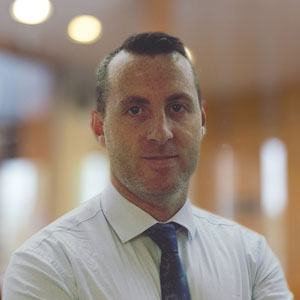
Shaun Ferris (CRS) demonstrates data collection methods.

Shaun Ferris (CRS) demonstrates data collection methods. Photo credit: KDMD.

A variety of emerging technologies connects the digital fieldworker to the value  chain, according to Shaun Ferris of Catholic Relief Services (CRS) in his presentation, “CRS ICT4D Strategy,” at the ICT4D (Information and Communication Technologies for Development) August Meetup. According to Ferris, project progress tracking and data sharing are two of the challenges his organization faced while collecting data from their beneficiaries.  New technologies and/or new uses of existing technologies are helping to bridge this gap. In his presentation to the ICT4D group, Ferris showed the audience that a combination of hardware, software, and data-sharing technologies were used to ensure a more efficient transfer of data.

In partnership with the IT-focused non-governmental consortium NetHope, CRS beneficiaries and the international agricultural community share their information via the “Humanitarian Cloud.” The Humanitarian Cloud concept borrows its name from the information technology term, “cloud computing.” Cloud computing, is “anywhere access” to data or, more simply, web-based data.  Universal access to data is vital in ensuring equal distribution of services, particularly to underserved areas.  Connecting to this Humanitarian Cloud from rural areas with limited internet access, however, was one of the challenges faced by Ferris’ project.

Recognizing the reality of intermittent internet access, the CRS project needed a data collection tool that was both available offline (for data input) and online (for data transmission).  In addition, they needed software which was available on mobile devices such as tablet PCs and smartphones.  To address this need, they found software in which they could create customized forms and collect data, both on- and offline.  Using a form designed in iFormBuilder and accessed via mobile device, the fieldworker or project staff member are now able to add data to the Humanitarian Cloud.

Access to remotely-shared data, however, is not without its caveats – as one participant brought up in her question to Ferris.   Ethical use of the data, as well, is an important consideration, continued the questioner, of which only the most technologically savvy of the fieldworkers might be aware.  Ferris echoed the questioner’s concern and mentioned that data integrity, fieldworker privacy, and responsible use of data in a “Facebook world” factor into their internal confidentiality processes.  To better address confidentiality of the data, Ferris mentioned the opportunity to learn from the best practices of mobile health data collection projects.  While data usage and confidentiality is important, the overall benefit, as another participant mentioned, of sharing data and the various positive outcomes it can produce, can be a worthwhile tradeoff in supporting fieldworkers.

Ferris also put the call out for Ag Technology providers and practitioners in his announcement of a possible CRS ICT4D conference in DC in November 2011.

The Grameen Foundation Center launched a comprehensive Android phone-based project for Ugandan farmers recently, that could significantly improve farming processes, but how sustainable is the initiative?

grameen-android.jpg

The project is a high-tech response to fundamental challenges in agriculture, including unclear pricing structures and markets, unreliable weather forecasts, and a myriad of inefficient or absent extension services about when and how to plant crops. Each Android phone has an open-source data-collection app that feeds into Salesforce.com.

The Grameen innovation counters the electrical challenges in the East-African country, that would otherwise doom projects dependent on electrical power, by utilizing rechargeable batteries which solar energy can sustain. (PC World reports on this in detail)

The project is organized around 400 select farmers, known as “community knowledge workers“, who own Android phones – and 3 in 4 of all their peers value their high-tech extension services. But an Android phone costs US$600 plus upkeep costs, nearly twice the per capita income in Uganda. So, how do these smart phone owning farmers acquire them legitimately? The project offers select farmers loans to purchase the phones. On the surface, this approach suggests a level of sustainability, but I have a two questions:

  1. Are the benefits of using a smart phone, compared to a regular phone, so great that a farmer ought to take a loan and bear upkeep costs (combined) twice his/her country’s per capita income simply to access information? Of course, information is important, but it is only one variable among many that must be resolved to result in improved earnings for the farmers.
  2. Even if in the long-term ‘community knowledge workers’ charge for the services they offer, and even pay a fee to the platform providers, how long will it be before they can recoup and repay their loans? What is the interest rate on these ‘Android loans’?

These are critical questions that ought to be answered in order for us to truly grapple with the potential economic impact of deploying this sophisticated technology.

Judy Payne, Shaun Ferris, and Grahame Dixie at the ICT4D meetup. Photo credit: KDMD.

Judy Payne, Shaun Ferris, and Grahame Dixie at the ICT4D meetup. Photo credit: KDMD.

On August 22, the ICT for Development (ICT4D) Learning Network hosted an expert panel on how ICTs, or information and communication technologies, are enabling agriculture and improving livelihoods worldwide. The event, held at the USAID Public Information Library, was co-organized by Appropriate IT and the USAID-funded  FACET Project, which is being implemented by FHI 360. FACET works to enhance agricultural value chains and facilitate trade in agricultural products across Sub-Saharan Africa by providing technical assistance on the use of ICT tools to improve competitiveness and productivity.

The first presenter on the panel was Grahame Dixie, the Agribusiness Unit Team Leader for the World Bank’s Agriculture and Rural Development department. Dixie’s presentation covered a lot of the new research by IFPRI and others about how farmers and people in agriculture value chains are using ICT and what the effects are. Focusing mainly on telephones (both public land lines and private cell phones), he explained that there is good evidence that phones are raising rural income (Peru), improving commercial farmer income (Philippines), and leading to changes in cropping mixes and marketing methods (Morocco). That said, according to Dixie, the most important function that phones seem to serve is to connect players in the value chain in a way that promotes trust between them, leading to sharing of critical market intelligence.

In Grahame Dixie’s experience, a critical area where technology can play a big role is logistics. To illustrate this point, he told this story about women backyard poultry producers in Bangladesh:

“[The women] found out that the prices that they received for their chickens was less than half that of the prices in the nearest major market. They decided to contact the visiting trader and demand an explanation for paying so badly. The trader explained that he had to cover all his costs of getting to and back from their village over the few chickens they could sell him, and he could not afford to pay them more. How many chickens would he need to buy to be able to pay sensible prices? Fifty, he replied. They found that he has a cell phone and now actively seek out sufficient chickens to sell from an extended group, and call him in when they have aggregated a sensible critical mass. The prices have increased–and this in turn has incentivized the production of more chickens.”

After talking with farmers, researchers have found that the most useful market intelligence appears to be the simplest—contact information, especially of buyers, input suppliers, and transporters. They also found that the crops for which ICT integration generates the most farmer benefits are high-value, semi-perishables. Another finding was that the person in the value chain who seems to benefit most is the trucker/trader with a cell phone. Dixie wondered if there may be a way to squeeze that additional profit now accruing to the trader to either end of the value chain to push more benefits to the farmers and/or end buyers.

As his presentation focused so heavily on cell phones and SMS technology, Dixie concluded with a brief look at costs. According to him, the prices of SMS messages in many countries are high and bordering on “iniquitous,” especially when compared to the cost of actually transmitting the message. The current cost/price structures, he said, might mean a role for regulators or possibly an open source software for broadcasting SMS.

One of the things that I spent a great deal of my time during the first half of this year is being launched today. With great support from Intel and Microsoft we at NetHope are launching a 60 page case study report on the use of information and communication technology (ICT) in the Pakistan floods last year.

In this report we look at how the humanitarian community responded, how ICT played a role in the response and how information management was utilized during the response.

Back in 2006, Paul Currion wrote a report on the use of ICT in the 2005 Pakistan earthquake. In our report we look back at his findings and identify ways in which things have progressed in these five years. Interestingly enough in many cases not much has changed.

One of the key things that has changed in these five years is easier access to connectivity. Whereas in 2005 most organizations relied upon V-SATs as the only available connection, the humanitarian organizations today relied much more upon broadband and mobile connections.

It is our hope that this report provides a great insight into the state of ICT and information management within the humanitarian system and that it generates discussions on how to further improve.

I want to use this opportunity to thank all those who contributed to the report, either by responding to our survey or be willing to participate in our interviews. Last but not least I want to thank everyone who helped review my often rough text and special thanks to our media queen Paige for making the report look so nice.

The report can be downloaded here

The World Health Organization (WHO) has released a compendium of innovative technologies that may address global health complexities and improve health outcomes in low-resource settings. It presents a snapshot of technologies, either under development or commercialized, that address specific health problems and offer proposed solutions. Each technology is featured in a one-pager which showcases the product functionality and specifications, developer’s claims of product benefits, usage information, development stage, as well as future work and challenges for the product. According to the WHO, the compendium 2011 aims to raise awareness of the critical need for development and dissemination of novel technology in developing countries.

Technology Under Development…

Assisted vaginal delivery instrument
Blood collection drape estimating postpartum blood loss
Fetal heart rate monitor by mobile phone
Infant warmer
Isolator system for laparoscopic surgery
Lab-in-a-backpack: point of care screening/diagnostic
Low-technology child restraint car seat
Microbial water testing kit
Mobile health record system for pediatric HIV
Mobile phone image transmission for diagnosis
Mobile phone pulse oximeter
Off-grid refrigerator
Orthopaedic external fixator
Pedograph
Point-of-use water purifier
Portable cell sorting and counting device
Portable system for pre-cancer screening at point of care
Portable telemedicine unit
Portable transcutaneous haemoglobin meter
Single-size contraceptive diaphragm
Subcutaneous drug delivery device
Woman’s condom

Commercialized Technology…

Birthing simulator for training
Fetal heart rate monitor
Isothermal nucleic acid amplifi cation system for POC diagnosis
Manual wheelchairs and mobility devices
Medical data communication system
Mobile technology to connect patients to remote doctors
Newborn simulator for resuscitation training
Non-pneumatic anti-shock garment
Oxytocin in prefilled auto-disable injection system
Parasitological test system
Phototherapy for neonatal jaundice treatment
Point-of-use water disinfection system
Portable haemoglobin meter
Portable ventilator
Prefi lled auto-disable injection system
Reusable neonatal suction device
Self-powered pulse oximeter
Solar thermal cooking and autoclave device
Transcutaneous bilirubin measurement system for infants
Treatment response software application
Ventilator using continuous positive airway pressure
Water filter

The following is a guest post we’re pleased to share by the GSMA’S Mobile Money for the Unbanked (MMU) programme, which seeks to accelerate the availability of mobile money services to the unbanked and those living on less than US$2 per day.

Outdoor advertising for free mobile money sending service in Kenya

One of my first posts for this blog explored how mobile operators could exploit the network effects that characterize mobile moneyservices by “subsidizing” early adopters—that is, by rewarding those who sign up and use a service early with deep discounts or bonuses to make up for the fact that there aren’t many other people on the network to transact with. It’s a classic pricing strategy in networked markets.

Recently, Airtel in Kenya launched a new promotion offering Airtel Money (formerly known as Zain Zap) customers free money transfers to both registered and unregistered customers. Although slated to run only for a short time, this promotion is a clear illustration of an attempt to subsidize participation in a network that has far fewer users than its competitor M-PESA, the most famous and well-established mobile money service in the world.

Such a move is risky, but not crazy. Ignacio Mas has pointed out that the online payments service PayPal lost $23 for every customer they signed up during their first 9 months of operation because they paid large sign-up bonuses and chose not to charge fees that were large enough to cover their variable costs. PayPal racked up millions of dollars of losses that way, but in the process it built a user base that it was later able to monetize: PayPal went on to a successful IPO and now has over 100 million active users around the globe.

For this tactic to work, a networked business must be willing to sustain losses up until the point that it has built a network large enough—which is to say, valuable enough—that users and potential users are willing to pay to use it.

We’ll see if this gambit pays off in Kenya.

Subsidizing early adopters is just one of the tactics that networked businesses can employ to exploit network effects. Previously, I’ve written about how network effects apply to mobile payments and their implications for target market selection and marketing communications.

Information and communication is the lifeline of any disaster response. It is critical for people on the ground to convey the situation, as well as the urgent need for supplies and relief in specific locations. It helps organizations collaborate to avoid duplicative effort and gaps in assistance.

The crisis response community has long known that the use of information and communications technology (ICT) can quickly coordinate efforts, thereby making their work more targeted and effective. Recent improvements in ICT, such as availability of BGANs, WiMax and WiFi mesh networks, provide an opportunity to improve information sharing, not only within organizations but also between them.

This blog post illustrates the need for a coordinated collection of baseline data in disaster prone countries through a cross-organizational, multi-phased approach.

The humanitarian sector has the opportunity to harness technological advancements to improve information-sharing during a crisis. Technology is not the solution. But it is a significant tool that can enhance intelligent and immediate decision-making.

The State of Crisis Information Management

Numerous challenges in information management arise when responding to a major disaster or conflict, such as:

  • recording the damage to housing, infrastructure, and services
  • tracking displaced populations
  • distributing the massive influx of humanitarian supplies
  • coordinating the work in and between clusters, as well as the work of dozens of agencies outside the cluster approach

A recent survey of organizations that responded to the devastating earthquake in Haiti pointed out that one of the key issues they faced was an overall lack of baseline information about the situation in the country. For many of the UN clusters operating, it took months to get a comprehensive overview of what the situation was like before the earthquake struck, and then to start understanding what effects it had.

In Haiti the situation was particularly devastating because almost all government offices and ministries had been destroyed in the earthquake, and most of their data systems were lost. This is a common issue faced by response organizations around the world.

Baseline and post-disaster information is collected and controlled by many autonomous parties, including national authorities, many of whom may be working together for the first time. Due to the lack of a common repository of baseline data, organizations spend considerable amount of time either recreating the data or searching for it. Therefore, it is important to improve access to, and interoperability of, data collected before, during, and after an emergency. This is essential to building better response capacity.

Humanitarian response to sudden onset disasters requires:

  • rapid assessment of the spatial distribution of affected people and existing resources
  • good geographical information to plan initial response actions
  • shared knowledge of which organizations are working where (who-what-where or “3W data”) so that response can be coordinated to avoid gaps and overlaps in aid

This applies to any humanitarian response. But in a sudden onset disaster, the timeframes of information supply and demand are severely compressed. Pre-assembled information resources for the affected area may not exist. Even in areas where development projects have been present before the crisis occurred, data is often dispersed and unknown by the wider humanitarian community, or cannot be accessed and assimilated quickly enough.

Recurring data problems include:

  • Discoverable data. Data is either not made available to, or is not discoverable by, relevant organizations.
  • Available data. Data may not be immediately accessible, archived, or stored/backed up in a location outside of the devastated area.
  • Released data. Data sets may be subject to legal restrictions. Even if these restrictions are waived for humanitarian use, there may be problems with immediate authorization and redistribution.
  • Formatted data. Data may be unsuitable for direct import into a database or GIS system, and may require substantial processing.
  • Conflicting data.

Emergencies create an ever increasing number of information web portals, which is in itself a good thing. However, it can be problematic when the data is rapidly evolving. The enthusiasm to (re)publish as much information as possible can lead to confusion and inefficiencies, as users search through multiple copies of similar looking data to extract what is new or different.

The above issues are widely recognized by practitioners in humanitarian information management. Still, these problems recur in almost every sudden onset disaster emergency, in both developed and developing countries.

Each emergency brings together a unique collection of local, national and international humanitarian players. Some are experienced emergency responders, and some are not. Some are government-endorsed, whilst others are simply concerned citizens. While there will be some common elements across every emergency (government, UN agencies, major INGOs), the varying roles played by each makes it impossible to predict a ‘humanitarian blueprint’ for each new emergency. This vast range of experience, resources, and mandates, can make sharing response best practices extremely difficult.

Common problems with baseline data can – and must – be resolved for each emergency. For example:

  • During the initial days of an emergency, the main coordinating agencies agree at a national or local level which administration boundaries and P-code datasets should be used for coordination. It is critical that this decision is communicated to everyone involved in the disaster response.
  • Humanitarian assessment templates and base map data should be standardized and made compatible.
  • The supply of baseline data should be driven by the information needs of the humanitarian response. Priorities differ from emergency to emergency, and this presents a constant challenge in using limited resources to meet urgent information needs at each stage of the response.
  • The information needed by the affected community is not necessarily the same as the information demanded by large humanitarian agencies.

A well-coordinated humanitarian response will use multiple datasets, created by different personnel in different agencies, describing a highly dynamic and multi-faceted situation. To make these datasets interoperable and manageable imposes a higher overhead cost. But to create a data model that is planned strategically versus reactively will minimize that cost.

Moving forward

A multi-agency effort is essential to improve the availability and accessibility to baseline and crisis information. This needs to be a collaborative effort of the entire humanitarian response community with support and involvement of the private and academic sectors. The now no longer existing IASC Task Force on Information Management did a good job by defining what the Core and Fundamental Operational Datasets (COD/FOD) are that we need to collect for each country, but the difficult part is to actually ensure they are available for each country and that those that have been collected are actually kept up to date.

We at NetHope are looking at new and innovative ways to address this and are looking for organizations who are interested in working with us on this. If you want to work with us on this, feel free to reach out to me for further information.

Over the last two years we have had endless discussions about how crowd sourced information is going to change the way we do crisis information management. Some people go as far to say as the regular humanitarian information management is dead and that the time of crowd has come. But one thing that we have yet to show is that all this crowd sourced information actually provides the humanitarian response community with actionable information. We have a few anecdotes of individual reports being helpful, but no overall study of the effectiveness.

I have lately been talking to a number of colleagues from the humanitarian community and one of the best hint at how to solve this came from Lars Peter Nissen from ACAPS. He pointed out that when they are planning needs assessments they start by defining what decisions they want to try to affect by the needs assessment. Then they work their way backwards and design an assessment that helps provide the answers needed to make that decisions.

When deciding to do a crowd sourced project for a disaster or crisis response, we must do the same. We must first define what decisions we are trying to affect. Once we know what decisions we want to try to affect, we need to define what information we would use as the basis for making these decisions. Once we know what information we would use as basis, we should look at what is the best way to visualize that information to optimize the decision making. In the age of crowd sourcing we have focused a bit too much on the power of geospatial visualization, but often graphs, trends or tables can help us make a better decision.

Once we know what decisions we want to help facilitate and how we want to visualize them, then we can start thinking of how we can get data from the crowd and through data processing and data analysis turn that data into this information. This may lead us to ask the crowds for more controlled questions or for our media monitoring teams to monitor reports of certain data instead of trying to capture all the available data out there. We can then look at ways of either automatically process the data or use a mechanical turk to utilize a “crowd” to do that processing. Same applies to taking that processed data and analyzing it. This can either be automatic or done via a crowd of people.

So before the next major disaster happens and we activate the digital volunteers lets sit down and define the end product first and then work our way back. This way we can really ensure that all this digital volunteer effort is utilized to the max.

Child being given vaccination. Photo Credit: getty images

India’s health minister announced earlier this month a new initiative designed to boost the country’s rate of immunizing newborns by collecting mobile phone numbers of all pregnant mothers to monitor their babies’ vaccinations over time.

Ghulam Nabi Azad, the health minister, told a World Health Organization meeting in New Delhi that his ministry has been supervising the collection of about 26 million mobile numbers of pregnant women in India since January and plans to finish the job by December.

The women whose numbers are collected will be tracked via the mobile phones in the future by the Indian government to ensure the women’s babies receive the proper immunizations at the proper times. Babies in India are supposed to be immunized against tuberculosis, polio, diphtheria, tetanus, whopping cough and measles, health experts say.

According to Mr. Azad, the campaign will “enable us to monitor our immunization service at a national level. In addition, the central government will be able to check on the accuracy of data collected locally, which is often in doubt.”

The impetus for this program manifested due to a decentralized and deficient public health system, poor monitoring methods and sub standard vaccination coverage.

Photo Credit: wisdomblog.com

In 2010, only 72% of Indian babies received the three doses of the DPT vaccine against diphtheria, tetanus and whooping cough, an accepted indicator of a successful vaccination program, according to a joint estimate United Nations Children’s Fund and the WHO. That compares poorly with Bangladesh at 95% and Indonesia at 83%, according to the same joint estimate.

An inherent problem with the monitoring of vaccinations in India is that once babies are vaccinated, there tends to be no physical record of that baby being vaccinated. It is up to the guardians of the child to remember which vaccination was administered at which time. Also, the district levels governments may report erroneous numbers when reporting on the number of children vaccinated.

This initiative will give the central government the ability to contact the new mothers to confirm their babies’ immunization. “We’ll know the capacity of each state so they can’t fool us,” said Mr. Azad, reflecting widespread frustration.

Such an encompassing initiative is bound to face obstacles. Mr. Azad already encountered problems when he tried calling ten numbers from a list gathered back in February. “In front of all of the ministers, I picked up the phone and dialed the first 10 numbers. Only six of them were accurate numbers. Knowing we were going to be checking these numbers, our health workers still collected 40% faulty numbers—that is very bad” he said.

Mr. Azad declined to detail the cost of the program or how many numbers have been entered into the government’s system so far. But he said that tracking 26 million babies “is not an easy job.”

This is an ambitious project to say the least. Mobile phones after all aren’t permanent tools. A family could potentially report one number and procure a new phone with a new number. Also keep in mind, the Indian government is talking about a series of vaccinations that will span over a number of years for families living in rural areas. There could be a high turnover issue of mobile numbers. Families could also report a false phone number for fear of government intrusion – there is no way of double checking for that. Don’t forget, not all mothers will have a mobile phone to begin with.

The list of possible impediments could go on, but the bottom line is that attaining 26 million accurate and functional mobile numbers is idealistic at best. Nonetheless, this is a good start for the central government – it shows they are paying attention to the issue.

Screen shot of the Agwired iPhone app

Credit: Calder Justice/ADCO

The outmoded view of agriculture, as a pre-industrial technologically obscure field, is rapidly changing. Increasingly, farmers are making use of Apps as smartphones become more accessible. I have blogged about a number of applications and ways in which non-profits and other development organizations are helping farmers to purchase these phones. But there is a growing number of new applications.

Here are five FREE agricultural apps recently reviewed by Calder Justice of AGCO, a high-tech solutions firm for farmers.

  • SoilWed – GPS based, real-time access to USDA-NRCS soil survey data, formatted for mobile devices. This application retrieves graphical summaries of soil types associated with the user’s current geographical location. Images are linked to detailed information on the named soils.
  • PureSense: Allows user to access information from underground sensors that detect moisture levels near the roots of crops.
  • Dupont Tankmix: Allows you to easily calculate the amount of product you will need to treat a specific field area, the amount of product you need to apply to a specific tank size, the amount of water you will need to treat a specific area or the amount of product you will need to get the desired volume to volume ratio.
  • AGWired: The first agricultural media app for the iPhone. The app offers one-touch access to all the latest news and information in the agribusiness and agricultural marketing world posted on Agwired.com
  • ArcGIS: ArcGIS is a great way to discover and use maps. You can query the map, search and find interesting information, measure distances and areas of interest and share maps with others.


Copyright © 2020 Integra Government Services International LLC