I work with a small NGO in the Cook Islands called Te Rito Enua. We recently concluded a pilot project funded by the Asian Development Bank to test the use of participatory GIS techniques to help develop community-scale climate adaptation strategies.  Some of our key findings echo those Oregon State University scientists Sally Duncan and Denise Lach.  As reported in the People and Place blog, they observe that

“Exchange of ideas and knowledge with the assistance of a technology that is both analytical and visual draws participants into new kinds of inquiry, calling upon broader kinds and definitions of knowledge and experience. In such a setting, GIS technology lends itself to the mapping of ideas as well as landscapes.(emphasis is mine)

In our own work, we found that that the approach provides communities with the tools to assess climate risk  according to their own frames of reference. Linking models with personal experience and traditional ecological knowledge gave the communities tangible evidence of climate risk that empowers them to own the problem and develop personal and collective responses based on their own needs and priorities.  The participatory GIS process highlights behavioral and development issues that affect the vulnerability of individual households and the community at large. There was a discernable sense of empowerment by participating communities in developing vulnerability maps and planning on the basis of the spatially organized information.

Replicating the process is problematic though.  We opted to use expensive high-end commercial GIS software to match the system used by the government. All the GIS expertise in the country (basically 2 people at the start of the project) were schooled in the use government system. We needed to work with those people.  But the high end systems are a formidable barrier to entry; acquiring the software, hardware, and training costs thousands of dollars.   Communities and NGOs lack those resources, and the emerging, computer-savvy generation lacks learning opportunities.  In our final report, we recommended the use of open source software and support for regional training to build up the GIS community.

Fortunately the support for open-source GIS is growing fast.  Some resources for beginners include:

The Participatory GIS Forum (www.ppgis.net) (and be sure to see the very helpful email list for PPGIS, links on the site).

Mapping Across Borders/Digital Distractions blog ( http://mikedotonline.wordpress.com/ )

Quantum GIS open source software (www.qgis.org)

And  a new site, Training Kit on Participatory Spatial Information Management and Communications (http://pgis-tk-en.cta.int/)

Don’t forget that good data layers can often be found at Data Basin, and you can upload and share your files there.  (www.databasin.org)

I’ve experienced significant resistance to participatory mapping in the past from the GIS technical community.  It is true that you can produce complete garbage in GIS.  And garbage, in planning, can be dangerous.  But the answer doesn’t lie in treating geospatial planning as an esoteric art and shunning the novices.  The answer lies in widening the pool of experts and providing support for grassroots initiatives.  Duncan and Lech observe:

“The frequent repetition of the phrase “re-framing the debate” during focus-group discussions highlighted the progression from the one-way communication model, in which scientists impart their findings, to the dynamic process of engaging GIS technology as a tool of inquiry, mediation, and communication. Ideas suggested for a broader debate included making assumptions explicit on GIS maps, using the power of GIS to examine new questions, and sharing responsibility for new kinds of learning. …”

Duncan, S. and Lech, D.  2006.  GIS Technology in Natural Resource Management:  Process as a Tool of Change.  Cartographica 41:3, 201-205.  DOI: 10.3138/3571-88W4-77H2-3617.

Sounds like development to me.

[The Te Rito Enua project report can be downloaded at http://dl.dropbox.com/u/1735507/ADB%20SGI%20report/Final%20Report-web.pdf]

Vine map superimposed on Google Earth; sources Benjamin White and Google Earth, all rights reserved

Over the past year, I’ve been working with a Cook Islands NGO, Te Rito Enua, with funding from the Asian Development Bank, to develop a pilot project on participatory GIS  as a tool to assist island communities to develop climate adaptation strategies. While there, Mona Matepi, president of TRE, called my attention to the problem of invasive vines on the island. Three species of woody vines* are colonizing the island forests, causing massive deforestation. They overtop and kill trees, replacing the forest with a solid jungle of vines.  Since Rarotonga is dependent upon surface water for its entire supply, and since vines were killing the trees in its forested watershed, it seems like a non-trivial issue.  Nobody knows how the vines will affect water supply.  Will they reduce surface water supply through evapotranspiration?  Will they hold the soils as well as the trees they are replacing?  How will they respond to the more frequent cyclones and droughts that climate models predict?  And, if they are a problem, how can they be controlled?  Many questions to answer – our challenge right now is to find support for research into the issues and the options available.  If no one does anything, there’s a chance, and its not a tiny one, that there could someday be a humanitarian crisis that would have severe implications for one of the dwindling number of robust Polynesian cultures remaining.

I asked University of Maryland doctoral candidate Benjamin White, a remote sensing specialist, for advice on how to illustrate the extent of the vine infestation.  The island is rugged and steep, difficult to map on foot.  But I was able to take some measurements using a handheld GPS unit.  Ben offered to have a go at classifying the vines using my field observations as training data.  Commercial remote sensing imagery provider GeoEye donated high-resolution (4m and 1m) satellite images. Ben developed a sophisticated neural net classifier, and processed the images as R/G/IR reflectance, reflectance-based NDVI, principal components, mean texture and a quick reflectance to “dense vegetation” classification.   The final result was uploaded to Google Earth for visualization purposes; Google Earth data is not useful for this kind of application, but overlaying the classification results on a Google Earth image gives a context in terms of location and topography.  Additional satellite imagery could provide complete ground coverage and (subject to availability) time series to measure change in land cover.

I’m hoping that the image will drive home how bad the problem is, and mobilize some support for Te Rito Enua and the Cook Islands government to get a handle on the vine problem.

Heartfelt thanks go to Ben White and the University of Maryland Geography Department, GeoEye, and the Asian Development Bank for support.

* the vines are Cardiospermum grandiflorum, Mikania micrantha, and Merremia peltata.

via GREEN HAND.

Eric Youngren, founder of Solar Nexus International, serves as a catalyst for reliable, rural power solutions in the developing world.  The Solar Nexus power center is an innovative solution for electricity that brings the quality tested North American off-grid solar installations to areas of the world where similar systems are rarely found.

The SolarNexus is an all-encompassing system, where all the high quality electronics necessary to convert the energy generated by the solar PV panels (or any other source of renewable energy) into power that is stored in batteries for later use.

SolarNexus power centers are sold as part of a complete package, shown here. The package includes PV panels, deep cycle batteries, mounting hardware, code-compliant wiring, and instructions

SolarNexus power center is designed for permanent indoor installation and includes instructions, training and support to ensure successful installations and build capacity in local communities. To understand how the Solar Nexus system operates, view this great introductory explanation on the Solar Nexus International website

Installation was performed by Ensol, of Dar es Salaam, TZ Photo Credit: Eric Youngren

A project was launched in April 2010, Solar Nexus International shipped 30 complete SolarNexus systems — including PV panels and deep cycle batteries — to Tanzania for a project run by the U.K. based charity SolarAid. The systems would be used to provide light and power to schools that were beyond the radius of the electricity grid.  The mission was to replace the old, smokey, and potentially dangerous kerosene lanterns with effective, compact fluorescent light. This improved visability would allow more local children to attend the schools.

Eric traveled to Tanzania to assist in the training of local installation crews and help facilitate aptitude.  One main goal of the founder and his company is to improve the knowledge, skills and capacity of the solar installers in the developing world to ensure the system’s sustainability and overall impact.

Visit the Solar Nexus International website and their blog for more information on current projects

I’ve been asked to be an editor of the environment and natural resources sector page of the GBI blog, so I’m writing a few words by way of introduction.  My name is John Waugh.  I live in the rural Virginia Piedmont, and have three decades of experience in natural resource management, running the gamut of conservation. I started out as a firefighter for the US Forest Service and US National Park Service (a little shout out to the old Flathead IR and the Arrowhead Hotshots). By turns I became a technician on fire ecology studies, a Park Ranger, and then, as a Peace Corps Volunteer, the manager of two World Wildlife Fund projects in West Africa.  This was followed by a long sojourn at the International Union for Conservation of Nature (IUCN), where I helped to develop a marine program, managed UN relations, and represented the conservation community at a range of intergovernmental processes addressing biodiversity conservation.  Work has taken me to over sixty countries on every continent except Antarctica.  For the past several years, I’ve been working as a private consultant conducting program evaluations, developing and implementing projects, and providing advice on conservation strategies and planning.

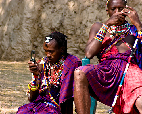
Through all of this, I’ve been watching with interest the liberating role that technology can play in natural resource management.  Recently I returned to Liberia after a 24 year absence to assist a USAID funded project on land rights and community forestry.  In a meeting with government community leaders, I experienced a moment of cognitive dissonance when cellphone calls interrupted the flow of the discussion.  24 years ago, it would have been impossible for community leaders to consult with their base while sitting in a meeting in Monrovia.  When technology can facilitate information exchange in real time, participation becomes a real possibility.

I recently completed a participatory GIS project with colleagues in the Cook Islands (I know, I know – you go bust your butt for 30 years and you too may get your chance!).  The goal was to facilitate community-based climate adaptation planning using maps.  We superimposed data collected by the community using handheld GPS units with satellite imagery, existing government map layers, and climate models, and  produced custom maps as the starting point for adaptation planning.  Sally Duncan and Denise Lach of Oregon State University describe what can happen: “the deliberative interactions … altered the power held in the privileged knowledge of scientists….GIS technology routinely used to generate such interactions, [can] potentially contribute to the development of new knowledge communities, in which public participation, scientific research, local/traditional ecological knowledge, and technology combine to change the nature and the locus of power in natural-resource management. …”

Of course technology can just as easily be used to achieve the opposite results.  The potential is huge and the change is rapid.  I look forward to exchanging views with the GBI Portal readers on opportunities, and on good practices, for the use of technology for NRM.

I also blog (intermittently) at www.green-hand.net, where you’re welcome to visit and chew the fat.

The Journal of Health Communication (JHC) is seeking inputs for a special edition focused on measurement and evaluation outcomes for mHealth.Manuscripts of no more than 3,000-words will be accepted until March 28, 2011

Cover of UHCM JournalJournal of Health Communication is now exclusively using an online submission and review system, Manuscript Central through which authors submit double-spaced manuscripts and track their progress. Hard copies of manuscripts will not be considered. Authors should enter the requested information into the system and submit the following files: (a) a cover letter file, containing any comments to the editor; (b) a manuscript file (submitted in Word or WordPerfect), containing the entire text of the article, including the title page (authorship omitted), the abstract, all text, references, footnotes, and appendixes; (c) figures and tables, which may either be included at the end of the manuscript file or submitted as separate files. Manuscripts, abstracts, references, figure and tables must conform to the Publication Manual of the American Psychological Association (2001, Fifth Edition) guidelines.

**Please indicate in your online submission form and in your cover letter that this is an invited submission for the mHealth Supplement**

Only original manuscripts submitted to Journal of Health Communication will be considered for publication. The cover letter should include a statement that it has not been published elsewhere and that it has not been submitted simultaneously for publication elsewhere.. All manuscripts submitted to this journal undergo editorial screening and blind peer review. Authors will be notified of the disposition of their manuscripts expeditiously.

For this suppliment, articles should be no more than 3,000 words plus appropriate charts, tables, and references. All parts of the manuscript should be typewritten, double-spaced, with margins of at least one inch on all sides. Number manuscript pages consecutively throughout the paper. Authors should also supply a shortened version of the title suitable for the running head, not exceeding 50 character spaces. Each article should be summarized in an abstract of no more than 200 words. Avoid abbreviations, diagrams, and reference to the text. Manuscripts, including tables, figures, and references, should be prepared in accordance with the Publication Manual of the American Psychological Association, 6th Edition.

The editors cannot respond to individual queries regarding the appropriateness of planned contributions. Please consult recent issues of the Journal regarding our scope of coverage of health communication issues. On our web site, you can view abstracts in specific subject areas at no charge. All other questions should be e-mailed to Wendy Meltzer at journalofhealthcommunication@gmail.com .

Authors are responsible for obtaining permission to reproduce copyrighted material from other sources and are required to sign an agreement for the transfer of copyright to the publisher. All accepted manuscripts, artwork, and photographs become the property of the publisher.

The Center for Global Development, released a paper indicating that mobile phones can impact literacy skills, and a sustainable model  may have been found. The paper is the result of an evaluation of a mobile education program, called Project ABC in Niger.

Projet d’Alphabetisation a Base Cellulaire, or Project ABC, works with non-formal education centers established by the Catholic Relief Services Niger Food Security and Nutrition Program (2007-2011), is funded by USAID/Food for Peace, and is implemented with CARE and Helen Keller International.

The project uses multimedia phones that have been programmed with a digital curriculum in the local languages of Hausa and Zarma, and incorporates a practical literacy component tied to obtaining market information via text message.

In the first year of ABC, participants learn basic cell phone technology, including SMS. In the second year, interactive multimedia phones and a digital curriculum that includes phonetic activities and varied texts are used to further develop literacy skills. Participants also use skills in literacy, numeracy, and basic cell phone technology in a companion program that teaches them how to request and retrieve market information via SMS.

According to the report:

Overall, students demonstrated substantial  improvements in literacy and numeracy test scores, suggesting that the adult education curriculum is effective in increasing learning. Students in mobile phone villages showed substantial additional gains in literacy and numeracy exam scores.

There is also evidence of persistent impacts: eight months after the end of the first year of classes, students in ABC villages retained what they had learned better than the non-ABC students. These effects do not appear to be driven by differences in the class time devoted to students, teacher experience or teacher and student attendance. Rather they can be partly explained by the effectiveness of mobile phones as an educational tool: Students in ABC villages used mobile phones more frequently to make calls, write SMS and search for price information as compared to their nonmobile phone counterparts. The program suggests that simple and relatively cheaper information and communication technology can serve as an effective and sustainable educational tool for rural populations.

According to Isbrandt, the program is operational in 56 literacy centers in the rural regions of Dosso and Zinder, in primarily agricultural villages. As is the case in most rural settings in West Africa, local language reading materials are otherwise scarce. Participants in the program include 1,400 learners, half of whom are women

References

Aker, Jenny C., Christopher Knoll and Travis J. Lybert, “ABC, 123: The Impact of a Mobile Phone Literacy Program on Educational Outcomes,” Center for Global Development Working Paper, September 2010

Isbrandt, Scott (2009) Cell Phone in West Africa: Improving Literacy and Agricultural Market Systems. Retrieved September 1, 2010.

IFC, a member of the World Bank Group, and the Soros Economic Development Fund have announced they will  invested $1.25 million of equity into Esoko, a Ghanaian technology firm. The investment in Esoko will give small holder African farmers and businesses timely crop information that can be shared via text messaging, enabling farmers to increase their incomes.


Mobile phones allows farmers to access crucial crop and market informaiton

Esoko’s software takes advantage of rapidly growing mobile-phone usage in Africa.  The technology allows farmers affordable and timely access to market information that can help them negotiate better prices and improve the timing of getting their crops to market.

“Our platform was developed by African software engineers here in Accra, Ghana, and has been a totally local, market-driven initiative,” said Esoko CEO Mark Davies. “IFC and SEDF have a strong track record of helping local companies get the funding and advice needed to expand into new regions and markets. With their support we hope to export this African technology all around the world.”

Esoko’s software allows different parties in the agricultural value chain to exchange real-time market information.  Farmers receive current demands, prices of crops, and the location of seeds and fertilizers directly on their mobile phones.  Businesses can track how their products are used and market themselves to new customers.  Associations and governments can share critical information with thousands using a simple bulk-text messaging feature.  Esoko’s technology is being used in nine African countries and expanding quickly.

“SEDF’s investment helps break the information barrier for African farmers so they can generate more income,” said Stewart J. Paperin, president of the Soros Economic Development Fund, a nonprofit investment fund that works to alleviate poverty and community deterioration.  “A more transparent marketplace enables farmers to negotiate fair prices, improve their timing on getting goods to market, and move between markets to sell products.”


Farmers receive relevant information directly to their phone

Esoko is also publishing the first commodities indices in Africa, a powerful tool in helping ensure that farmers are fairly compensated for their crops, as formal commodity exchanges are very rare on the continent.  The company is initially publishing two indices that provide prices for 12 agriculture commodities in seven markets in Ghana.

“African technology firms are innovating and expanding beyond their domestic markets and we see a great opportunity to help ensure they have the proper financing for long-term growth,” said Kent Lupberger, Global Head of IFC Techonology, Media, and Telecom.

“Esoko is giving people practical tools to improve their lives and lift themselves out of poverty.”

There are 22 days left to submit proposals for innovative ways to address disaster recovery for the World Reconstruction Conference (May 10-13 2011  in Geneva).  Winners will be invited to the conference.  All qualified entries will be invited to submit a poster presentation of their idea.

From the website:

“The focus of the competition is on innovation in services, products and approaches that have been implemented at the local level in disaster recovery and reconstruction. The aim is to:

  • showcase innovative and new solutions developed in the wake of disasters;
  • develop awareness for their use in other and future recovery operations;
  • provide a space to build partnerships to address key challenges in scaling up and replicating.

“Sectors of interest include but are not limited to: housing, water and sanitation, education, health, energy, transportation, information and communication technology (ICT), monitoring and evaluation, environment, governance and institutional strengthening.”

Let’s get some ICT proposals out there.

This working paper by Jenny C. Aker and Isaac M. Mbiti for the Center for Global Development examines the growth of mobile phone technology over the past decade and considers its potential impacts upon quality of life in low-income countries, with a particular focus on sub-Saharan Africa. An overview of the patterns and determinants of mobile phone coverage in sub-Saharan Africa is first presented followed by a description of the characteristics of primary and secondary mobile phone adopters on the continent. The paper also discusses the channels through which mobile phone technology can impact development outcomes, both as a positive externality of the communication sector and as part of mobile phone-based development projects, and analyze existing evidence.

While current research suggests that mobile phone coverage and adoption have had positive impacts on agricultural and labor market efficiency and welfare in certain countries, the paper notes that the empirical evidence is still somewhat limited. The paper also argues that mobile phone technology cannot serve as the “silver bullet” for development in sub-Saharan Africa, and that careful impact evaluations of mobile phone development projects are required to better understand their impacts upon economic and social outcomes. The paper also notes the need for mobile phone technology to work in partnership with other public good provision and investment.

For more information and to view the working paper please click here.

This blog post from khokhar.net describes four ways to simulate a slow Internet connection and also provides a brief background on why it can prove useful to you!

Copyright © 2020 Integra Government Services International LLC